 Pronghorn (Antilocapra americana)
Usually called (in error) Antelope
Taken 6/6/09
Centennial Valley, Beaverhead County, Montana
NOTE PLEASE: Clicking on any photograph will open a full-screen version of that photo in a separate window. All links also open in a separate window.
He roamed near the place where his true love was slain
He wept bitter tears, but his cries were all in vain.
As he looked on the lake, a swan glided by
And the sun slowly sank in the grey of the sky.
She'd her apron wrapped about her and he took her for a swan
But it's oh and alas it was she, Polly Von.
He wept bitter tears, but his cries were all in vain.
As he looked on the lake, a swan glided by
And the sun slowly sank in the grey of the sky.
She'd her apron wrapped about her and he took her for a swan
But it's oh and alas it was she, Polly Von.
--Yarrow/Stookey/Travers- Pepamar Music ASCAP
For a youtube version of this song, click here.
Kevin promised me a swan. Actually, he promised me lots of swans. Trumpeter swans nesting in Montana's Centennial Valley. And it being the time of year it is, there might even be, probably would be, some cygnets as well--but I think he called them "baby swans." This was the day we were out on Brown's Lake, Memorial Day, that is, when I kept playing hide and seek with the Great Blue Herons. It just amazes me how such a large, ungainly bird can hide in a few reeds. I've posted the portrait of that GBH on Eyefetch, if you care to see how the match ended.
Friday evening (June 5th, 2009), I suggested to Kevin that I would not be averse to a road trip on Saturday--off to find the swans in the Centennial Valley. Mind you, I wasn't exactly sure where the Centennial Valley was, just that it's in Beaverhead County somewhere. What I did know was that Beaverhead County is Montana's largest county in area. If you look at Montana's border with Idaho as forming a face, Missoula, where I live, is in the eyesocket, Ravalli County where my cabin is located, is the nose, and Beaverhead County is the mouth and chin. It measures 5,572 square miles, and the 2000 census shows a population of 9,202 people, over 95% of whom are white. Of those nine thousand folk, 3,752 live in the county seat, Dillon. That leaves 5,450 folk spread out over the landscape, or less than one person per square mile. Looking at it another way, Beaverhead County is larger than the state of Connecticut, and considerably larger than Rhode Island and Delaware combined.
 Less than 1 person per square mile Taken 6/6/09 Centennial Valley, Beaverhead County, Montana
Driving north on Interstate 15, you enter Montana at Monida Pass which separates Clark County, Idaho, from Beaverhead County, Montana. I have driven I-15 many times, in both directions, and knew that part of the county traversed by the interstate. I have visited Dillon on numerous occasions, as well as the area north and west of Dillon, specifically the Big Hole Valley which I wrote about last September. The Big Hole Valley is so large that quite frankly I ignored the rest of the county. When Kevin talked about the Centennial Valley, I thought we were headed to Clark Canyon Reservoir which sits alongside I-15 south of Dillon. Live and learn.
Our favorite local weatherman (and fellow Bass in the Missoula Gay Men's Chorus), Mark Heyka, had forecast flooding in the southern Bitterroot, and I woke to very gray skies on Saturday morning. Oh well, when you're trying to photograph nesting birds, overcast skies are not a bad thing. Kevin surprised me by getting up all bright eyed and bushy tailed at 6:30. Shower, dress, give Rocky his morning insulin shot, and we headed out the door. Kevin had already installed a ham radio outfit in the Saab, and I added my camera bag and a change of clothes--in case I got soaked while hunting the swans. What neither of us thought to throw in the car was road food.
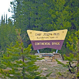
Driving up the Bitterroot on US 93 (which in old-tyme Montana terms means driving South), we watched the river flowing nearly bank-full, but didn't see much flooding. As we approached the Idaho state line at Lost Trail Pass, we turned east on Montana 43 and crossed the Continental Divide at Chief Joseph Pass. At 7,264 feet, Chief Joseph Pass is the home of one of my favorite cross-country skiing areas. I pulled into the ski area parking lot, and headed for the outhouse. Once seated on the throne, I looked over at the opposite wall and called for Kevin to bring me my camera. I mean how often do you get to take the portrait of two large daddy-long-legs (I think Harvestmen, not Cellar Spiders) on a plain white background. Unfortunately, Kevin brought me the camera, but not the bag, so I was stuck with the long macro lens and had to take the portraits from across the room. (Yes, I know, I could have gone to get the bag and changed the lens--hindsight is 20/20 after all.)
Driving down Montana 43 into the Big Hole, I asked Kevin to stop alongside Trail Creek. As often as I have driven this stretch of road, I have always promised myself that I would get some shots of the rail fences that front the road. Shooting not just the fence, but also the creek and some of the nearby rock formations, I marveled at the fact that this small stream was on its way to become the mighty Missouri River.
 Trail Creek with Rail Fence
Taken 6/6/09
Near Chief Joseph Pass, Beaverhead County, Montana
Back in the car, I next directed Kevin to stop at the Big Hole National Battlefield. I always get the chills when I stop at the Battlefield. The landscape looks so peaceful, but the battle was so fierce between the US Cavalry and a group of people who only wanted to continue to live their lives in peace. I've written about the battle before in the blog referenced above.
Leaving the park (Big Hole National Battlefield is now part of the Nez Percé National Historical Park), I caught sight of some wildlife, and had Kevin stop and roll down his window. I leaned across Kevin aiming my camera out the driver's side window. The gopher practically posed for me, even though Kevin never saw what I was photographing. When you're looking for wildlife to photograph, you take what you get.
 Big Hole Battlefield
Nez Percé National Historical Park
Taken 6/6/09
Near Wisdom, Montana
Heading further east on Montana 43, we approached Wisdom--the town that is. There were several antelope in the fields with the cattle, but Kevin didn't stop promising that there would be plenty of antelope (OK, pronghorn) when we reached our destination. So now he's promising me both swans and antelope. Hmm, if we run into buffalo (bison) and deer, we can have quite a song fest.
At Wisdom, we turned south on Montana Secondary 278 heading toward Jackson. Past Jackson, and its famous Hot Springs, we turned off 278 to visit Bannack, Montana's first territorial capital. It has never made sense to me that Bannack would be chosen as a capital, especially as it's located in the relatively empty southwestern corner of a rather large, and still relatively empty, state. Today the ghost town is a state park, and the caretaker informed me that back in 1864 when Montana Territory was created out of Dakota Territory (east of the continental divide) and Washington Territory (west of the divide), the gold camp of Bannack was one of the largest settlements in the area. OK, I'll have to accept that, but it still seems a bit bogus to me. Still and all, the area is rich in history and apparently the state has found some money to put into the park, because the place looked a lot better than I remember it. Kevin and I wandered through the "town" and I got several interesting shots, including a bunny just outside the old jail. More wildlife to capture, I tell you.
 Retired Red Pickup
Taken 6/6/09
Bannack, Montana
We left Bannack, driving south on the Bannack Bench Road, heading toward the Horse Prairie country. This is the land to the west of Clark Canyon Reservoir, and I was still thinking this was the Centennial Valley. We drove through the Horse Prairie, past Clark Canyon, and stopped for lunch at my favorite I-15 wide spot in the road, the Dell Calf-A. As this post is getting a bit wordy, and we have just stopped for lunch, I'll stop for now and take up the drive in my next posting.
Specifics:
Left Missoula 6:30 a.m.
Arrived Missoula 8:15 p.m.
Total Miles 500+
Counties traversed: Missoula, Ravalli, Beaverhead, Madison, Jefferson, Silver Bow, Deer Lodge, Powell, and Granite.
Photos taken 125
Click on the picture below to be taken to the album/slideshow. (100 photos, mostly unedited)
 |
| 20090606 |
And if you just haven't had enough music going through your head yet, let me recommend that you visit my on-line friend Michael's blog: The 007 GentleMan Blog: Afternoon Delight


2 comments:
My family and I have made a similar trip several times. We love Bannack, and I enjoy all the open space along 278. Have you spent any time around Polaris? The beautiful Pioneer Mountain Scenic Byway is worth the drive. There's Elkhorn Hot Springs and Crystal park out that way too. We'll be headed out there next month, I think.
I just discovered that you've linked to my 365 on your blog. Thanks! I'd love to hear any comments you have!
Can't say that I've spent a lot of time around Polaris, but I have enjoyed camping near Elkhorn Hot Springs (and soaking in the pools and eating in the restaurant there). Last time I drove across from Wise River, past the Crystal Park. At that point, the pavement ended at the crest and was dirt road on down past Elkhorn. I'm told it's all paved now. I'll have to check it out.
--Bryan the PK
Post a Comment